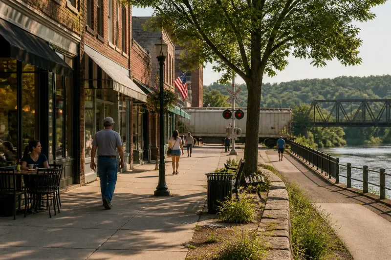
Why Rivers Leave Their Mark on Southern Towns
Why rivers leave their mark on Southern towns: read streets, slopes, floodplains, and crossings to separate visible geographic clues from origin stories.
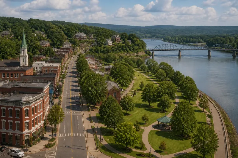
Why rivers leave their mark on Southern towns is easiest to see from a bridge, where streets, slopes, and low ground line up in a single view. The pattern can suggest how people moved through a place, but it does not, by itself, explain why the town began. Read the land first; treat origin stories as claims that need their own evidence.
1. Read the street grid as a record of movement
Look at a town map with the river visible, then follow the main streets toward the water. Some roads run parallel to the bank. Others angle toward a landing, bridge, ferry approach, or broad gap in the riverfront. Those alignments show where movement has been concentrated, or where planners expected it to go.
A street that ends at the river may once have served a landing, or it may simply stop where later development met a difficult bank. A road that bends inland could be following higher ground, avoiding wet terrain, or connecting to a route that predates the present street grid. The shape is a clue, not a caption.
Compare the map with the street itself. Look for changes in paving, width, direction, and building frontage. A broad road aimed at a crossing carries a different practical signal from a narrow lane that reaches the water without a clear continuation. Neither feature proves a particular founding story.
2. Notice where the ground rises
River towns often have a visible divide between the low, flat land near the channel and higher ground farther back. The change may be a gentle slope or a distinct bluff. On foot, it can show up as a long climb, a sudden change in street grade, or older buildings clustered above a low riverside strip.
That arrangement helps explain town layout. Higher ground can offer a drier place for homes and civic buildings, while low ground may have been useful for access to boats, storage, industry, or open space. But a present-day building pattern cannot tell you exactly when each use began. Fill, levees, road projects, and redevelopment can alter the old relationship between town and river.
To read the terrain, use a topographic map from a public mapping service or compare the contour lines in a USGS topographic map with the street pattern. Contours packed close together indicate a steeper slope; wide spacing suggests a gentler one. On the ground, note where sidewalks rise and where storm drains or retaining walls mark a change in grade.
3. Treat floodplains as terrain, not a town’s biography
A floodplain is low land beside a river that can be inundated when water spreads beyond its usual channel. Its presence matters to street layout, open space, and the location of buildings. A riverside park, vacant tract, or industrial yard may occupy ground that is difficult to develop, though the reason for its current use could also be recent planning or land ownership.
Flood maps can help distinguish a low-lying area from a safe-looking stretch of bank, but maps describe risk under specified conditions rather than the entire history of a neighborhood. The Federal Emergency Management Agency’s Flood Map Service Center is one place to check mapped flood hazards. Local floodplain offices may have additional maps and records. For decisions about a specific property or project, consult local officials and qualified professionals.
Imagine you are looking at a town where a broad park lies between the main street and the river, while homes sit on a low ridge behind it. That pattern is consistent with a layout that keeps routine activity on higher ground and leaves the river edge open. It does not establish that the park was always open land, or that a past flood created the arrangement; old maps and local records would be needed to support either claim.
4. Find the crossing, then ask what it connects
Bridges and ferries make routes visible. A bridge may carry a road straight through town, connect neighborhoods on opposite banks, or funnel traffic onto a single approach. The street network on both sides matters: a crossing is more legible as part of town life when roads continue toward shops, homes, or regional routes rather than ending at the bridgehead.
Crossings also change. A ferry may give way to a bridge; a bridge may be rebuilt or moved; a newer highway crossing may bypass the older center. A town’s current busiest route therefore may not mark its earliest one. Compare historical maps, transportation records, and the present street grid before assigning a date or purpose to a crossing.
Where no bridge appears, do not assume the river was a barrier. A ford, ferry, or seasonal route may have served the area, and its traces may be faint. Conversely, a bridge does not prove that a town began there. It may have been added after the town was already established.
5. Separate geographic clues from claims about origins
Maps and landforms are good at showing relationships: a road approaches a narrow point, a town occupies a bluff, or a low tract interrupts the street grid. They are less reliable at explaining who chose the site, what trade mattered, or which event prompted settlement. Those questions call for documentary evidence, not a confident reading of a map alone.
For a fuller account, compare Sanborn fire insurance maps, county atlases, historic topographic maps, city directories, local archives, and public histories. Each source has limits. A map may show buildings without explaining why they were placed there; a local account may preserve useful knowledge while compressing a complicated sequence into a neat origin story.
When a claim appears, ask what would make it observable. If someone says a town grew around a ferry, look for ferry references in records, an approach road, or maps showing a landing. A road aimed at the water supports the possibility of river access, but it is not enough on its own to establish a ferry or a founding date.
What can a river town’s layout tell you?
Does a street ending at the river mark an old landing?
It may point toward a former landing, but the street’s direction alone cannot establish that use. Look for historical maps, place names, and records that identify a landing or ferry.
Why are some older buildings above the river?
Higher ground can be more suitable for regular building and travel than a low floodplain. The pattern is geographic evidence, though it cannot date a building or explain an owner’s choice by itself.
Can a bridge show where a town began?
A bridge shows a route across the river, not necessarily the town’s starting point. Check whether the bridge replaced an earlier crossing and whether streets on both banks connect to older town centers.
Where can I check a town’s floodplain?
Start with FEMA’s Flood Map Service Center and the local floodplain office. Mapped hazards can clarify the land’s present classification, while local records may add context about changes to banks, levees, or development.
6. Use the river as a clue, not a verdict
A river leaves its mark through practical constraints and opportunities: the slope of a bank, the reach of a floodplain, the location of a crossing, and the streets that connect to it. These features make a town’s layout easier to read. They do not turn geography into a complete origin story.
For a careful reading, note what you can see, name the explanation it suggests, and keep the two separate. That habit makes the answer to why rivers leave their mark on Southern towns more precise: the landscape shapes choices, while records help establish which choices people actually made.